I recently attended a lunchtime talk at at the San Francisco Planning & Urban Research Association (SPUR) entitled “International Experiments in Public Space" featuring Tilly Chang of the SF County Transportation Authority, John King, Urban Design Critic and columnist at the SF Chronicle, and Kit Hodge of the SF Bicycle Coalition/Great Streets Project. SPUR has been addressing issues close to my heart recently – including hosting one of my all-time favorite organizations, waterscaping design studio Atelier Dreiseitl. I first saw Atelier Dreiseitl at the German Embassy in Washington, DC and then stalked them all the way across the country to their gorgeous "water park” in Portland, Oregon (below).

Here I am at Tanner’s Creek Park by atelier dreiseitl in Portland, Oregon’s Pearl District, Spring 2010
While I couldn’t make it to see the Dreiseitl talk, I thought Wednesday’s discussion at SPUR would be a great opportunity to catch up with San Francisco’s take on international cooperation. With my background in international relations, including my Master’s research on human landscapes and my past two years working with the German government, I was quite interested to hear how San Francisco was partnering with its international colleagues.
Mary McCue of the SPUR board gave a brief welcome, and Hodge kicked off the event by giving some brief remarks, followed by the introduction of Tilly Chang. Chang began her presentation by sharing photos of popular large-scale public space projects including Paris, France’s “Paris Plage”, London, England’s “Very Important Pedestrian Day”, and New York City’s Times Square Plaza. She also introduced San Francisco’s “Better Streets” program and “Pavement to Parks” – all great initiatives that caught my attention soon after moving here. Chang showed the audience an assortment of successful “parklets”: a public seating area created from one or two former parking spaces adjacent to the sidewalk.

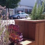
Parklet in front of Mojo Bike/Coffeeshop on Divisadero right near my place. Photo courtesy socketsite
In her presentation, Chang also indicated that certain sections of Market Street, including those separated green bikeways with my friend, the mushroom-headed cyclist, were indicative of a successful cooperation between the Planning Department, MTA, and Department of Public Works. They look nice, but unfortunately there aren’t any on the downtown section of Market Street I was biking on regularly.

Photo of Market Street separated bike lane courtesy Streetsblog
Chang finished her discussion with a slide show of future projects meant to turn alleys into better public spaces – particularly Minna and Natoma alleys downtown. A key challenge in the planning of the alley spaces may be engaging the community in the upkeep and care of the space, as well as making them ADA compliant.
Rounding out the panel, John King presented a slide show of his whirlwind tour of all of San Francisco’s parklets – including a new one right in my neighborhood at Fulton and Divisadero! I was quite surprised to see the photo, but then realized that since I broke my foot I haven’t actually been able to get that far away from the house – I probably haven’t even gone past McAllister Street. I can’t believe there’s a neat new urban design project going on only blocks from my door, and will be sure to post photos later this week when I check it out.

Location of your new neighborhood parklet, above
Quick to point out that he didn’t have any trouble parking during the day near any of the parklets – King anecdotally suggested that taking away one or two parking spots didn’t seem to make a major difference in parking difficulty. King also emphasized the new signage on all of the parklets indicating that the seating is open to the public – while also showing us how several of the parklets front directly on cafes or restaurants, lending the impression that they are café seating only. King concluded his presentation by noting that in order for public space projects to succeed, they must work long term and be more than a trend – he pointed out a park edge project in Bernal Heights as an example of cooperation between residents and the DPW that has the potential to be tended properly and last a long time.

Of course, park-"lets” need plants to be more of a park than a parking space.
The presentations at SPUR were a great overview of the parklet program and indicative of the commitment by San Francisco and its business community to spend time and resources on public space projects. I was disappointed not to hear more from Kit Hodge, however, and I was also looking forward to hearing a bit more about the “international experiments” promised in the event’s title and photos published on SPUR’s website.
International exchange for urban planning and livable cities is an incredibly fruitful area for exploration and I am eager to see San Francisco do more with this opportunity. When the slide photo of Paris’ “Urban Beach” – on a converted waterside expressway – went up, the accompanying sentiment was simply that it was a neat idea. I wanted to shout “So what if that was the Embarcadero?” In fact, it is possible the landscape of the Embarcadero may be due for some big changes due to the upcoming America’s Cup planning – more on that later.
Unique, large scale, and innovative uses of public space – particularly in urban areas, and particularly when they include landscaping and waterscaping – are a huge draw for the media, for tourism, and for the international design and planning community. One need only look at the constant media adoration generated by the High Line Park in New York City – it is almost as if it were the only park in Manhattan. The media and tourism frenzy surrounding the park hasn’t abated since its debut, and that’s a good thing. Honestly, who gets excited about another multimillion dollar downtown office complex or a new block of blandly colored “luxury” condos that will do nothing for the streetscape?

High Line Park NYC courtesy of Inhabitat
The benefits for city dwellers, their civic pride, and the opportunity to use and enjoy these spaces are infinite. Thinking about the Embarcadero, I’m reminded of the Düsseldorf Rheinuferpromenade – which was developed as a multi-use pedestrian promenade with cafes, boat moorings, beer gardens, benches, trees, and grass. The promenade was wonderfully built over a former motorway, and is now a huge draw for locals and tourists. The river’s edge is set against the backdrop of the old city downtown, and there is no 9 lane pedestrian crossing required to mingle back into the old restaurant quarter.

Photo credit Virtual Tourist
Having experienced the promenade as a resident, it was a wonderful place to take a lazy Sunday afternoon bicycle ride, sit at a cafe, or just walk year round. The trees and landscaping added a touch of shape and color in the winter months that is sorely missing from many modern concrete embankments and human-managed waterscapes, and the multitude of benches provided spots to people-watch, eat lunch, or track the progress of on of the huge river-barges. Like the Embarcadero, the promenade is centrally located, at a hub of Düsseldorf’s public transportation, and being on the waterfront, it is a natural “walking hub” to other areas such as botanical gardens, art museums, the old downtown, bars, and tourist attractions like the bridge and Frank Gehry buildings.

Rheinuferpromenade from the south, photo from Nordrhein-Westfalen Tourism
I’m curious about San Francisco’s participation in international exchange programs based around transit, public space, and sustainability issues since the SPUR presentations didn’t actually address this. The Northern Virginia Regional Commission, for example, has a long-standing program of cooperation with the German city Stuttgart on urban sustainability issues – in addition to workshops and programs, city leaders participate in actual exchanges to see and feel firsthand how various projects are working.
I was also rather surprised that the presentation at SPUR did not make the connection to the next day’s presenters, Atelier Dreiseitl. Dreseitl’s studio is a prime example of international inspiration and cooperation for better spaces and places with an ecological focus. Based in Germany and with offices in Portland, Oregon as well as Singapore, the studio has used its focus on “waterscaping” to address out-of-the-box environmental and design challenges across the world, including keystone work in Singapore addressing water management issues. The nexus of environmental and engineering challenges with design and community involvment is a key area for San Francisco to address in coming years.

Another view of Tanner Creek Park, Portland, OR – April 2010
While I have come across a few examples of international and regional cooperation since arriving here – the Delta Alliance (which includes the SF Bay area, the Mekong river delta area and the Netherlands among others) and the Global Green Cities conference in February – I am curious to learn if there are more. There may well be many initiatives I’ve not yet heard of, which is what I was hoping to learn about at the SPUR presentation.
Many cities and regions across the world struggle with the same challenges of population growth, aging transit systems, integration of technology and climate change planning. While each region has its own challenges due to environmental and cultural factors, there are many areas where cooperation and idea sharing can lead to innovation, partnership, and even investment. I would like to support this work, and I’m curious as to who in the San Francisco Bay area is investigating the potential to host other city planners and designers in reciprocal idea-sharing and best-practices exchanges. If you know more or have comments, please contact me.


